
Aerial Inspection & Analysis
Aerial Drone Inspection Services In India with our professional services & Team of Experts. At Klicko Production House, using aerial photography, we indulge in high-quality aerial shoots to deliver panoramas, images, and video tours of nearby facilities. Comprehensive and imaginative aerial imagery enables businesses to sell their property quicker and appealingly project them to their clients.
Stunning footage of events with 4k resolution and 20-megapixel drone images while sustaining audience safety. Besides creative video captures, quadcopters are used to capture aerial images of power plants, high-voltage towers, buildings, nature, events, etc. Gain a whole new perspective on your project with aerial imagery!
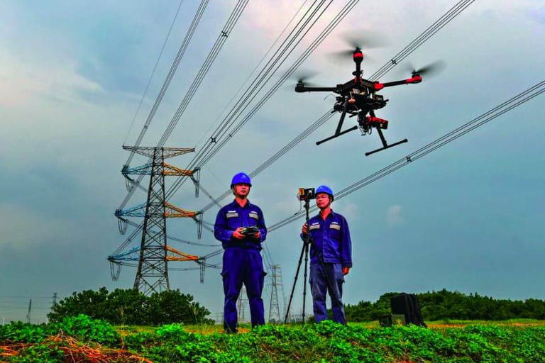
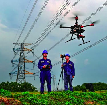
POWERLINE INSPECTION
With our Drone powered Aerial Inspection, we can identify Tower Concrete basement defects, Insulator overheating, Wire overheating, Wire breaks, Tower mechanical defects, Wire sag estimation, etc with very high accuracy. Our Powerline Inspection drones are equipped with ferro-magnetic protection hence can safely fly close to the powerline. Drones enhance maintenance, identify potential issues, and reduce downtime. From aerial LiDAR to thermal imaging, empower your power transmission line management with efficient and advanced drone solutions
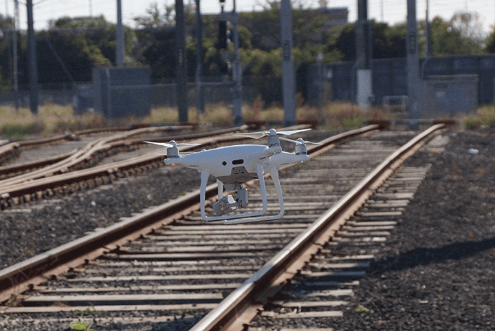
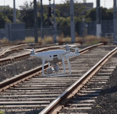
RAILWAY TRACK INSPECTION
Drone inspections represent the ideal approach for scheduled inspections and maintenance of heavily-trafficked railway tracks. We conduct comprehensive inspections of critical track components, including switch motors, points levers, point machines, conversion facings, point locks, joints, and guard rails (check rails), etc. Drones optimize surveying, track monitoring, and asset management, ensuring streamlined operations.


SURVEYING / MAPPING
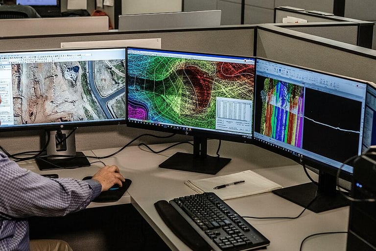
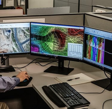
UAV DATA PROCESSING
We extend services such as GIS, Drone Surveys, Land Surveys, Stockpile Volumetric Analysis, Slope Monitoring, LIDAR, contours, and Urban Planning. Multiple deliverables include Orthomosaic maps, 3D Point Cloud, DEM, and DTM with centimeter-level accuracy, and 99% accurate volumetric analysis and measurement. Our drone surveying and mapping expertise ensures precise and reliable results for diverse projects. Utilizing UAV drone survey techniques, we offer unparalleled UAVs for surveying and mapping services, making us a top choice for drones for mapping and surveying.
We have a team of GIS experts and advanced compute servers to process and map large data sets. We offer deliverables such as orthomosaic maps, 3D point cloud maps, digital terrain models, digital surface models (DSM), and contour maps. Our UAV mapping drone and UAV drone survey capabilities ensure precise and detailed results. Utilizing UAVs in surveying, we provide high-quality services with our advanced UAV drone and aerial UAV technology.